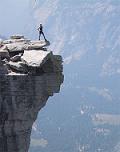
A Bad-ass/Bad-idea Loop at Mount St. Helens
- Categories: Mountain Biking
- Comments(0)
- Previous Post
- Next Post
This loop refers to: Ape Canyon, Plains of Abraham, Smith Creek, and Lava Canyon
If our friend Tom had been on the ride, I’m very certain that he would have proclaimed that this ride had a very high BS factor, and I would have agreed.
Riding at St Helens does not have to have a high BS factor, especially if you just do Ape Canyon to Plains of Abraham, and turn around when the going gets rough, it can be a very pleasant ride with spectacular views that cannot be matched by most other rides. When I planned the Ape Canyon – Plains of Abraham – Smith Creek loop, I had expected the ride to be tough from what I had read or heard; the ride turned out to be even tougher than I had prepared myself for.
The climb on Ape Canyon was quite nice under the trees. No mosquitoes bugged us. We then marveled at the view of St Helens and the moon-like terrain at Plans of Abraham. But the further we went, the looser the ground became. Sometimes, the ground was so sandy that our tires could not get any traction at all and we had to get off the bikes and push. It was slow going. When we arrived at Windy Ridge, I was so excited that I hopped curbs while going into the parking lot (so nice to be on firm ground again), and I knew while hopping that I made a mistake — sure enough, I got a pinch flat when the rear tire hit the curb. It didn’t take me long to swap tubes though and in the mean time, we got to listen to the presentation by the ranger.
Next, we would take Smith Creek Trail back and make it a loop. OMG! I didn’t remember ever having ridden in deep powder for so long. We were going down steep hill side, but I couldn’t go fast at all. Often times, I was dragging one foot on the uphill side while sliding down the trail across the hill side, and sometimes, I had to walk my bike downhill! Argh! I’m sure someone who is experienced with this stuff can make good speed (although I doubt that many can made the tight, loose, and off-camper switchbacks), but not me — I came from the Bay Area! I was so happy when we finally got to the creek in the valley. There were still loose spots, but at least the rideable stretches got longer. Actually near the bottom, we reached a corridor lined with alder trees where it was really peaceful and wonderful. I almost felt that that section made up for the BS sections earlier on, but it was just “almost”.
According to the official map, there was one singletrack (Trail # 184) that would lead us back to the car from Smith Creek Trail. The trail post said it was “Open to Hikers”, which made me wonder if we were supposed to ride it, but at the ranger station, the ranger lady told us excitedly that “oh, I heard that there was a ladder on the trail. Some bikers may have put a rope there so you can haul your bike up.” She didn’t say anything about not riding that trail, so we turned on that trail — Lave Canyon Trail (#184). Big mistake! Gigantic mistake! We saw the ladder alright, about 50 feet tall, dead vertical, but that was definitely not the hardest part on the trail when it comes to mountain biking. Oh, there was not a rope at the ladder. That trail was not designed for mountain biking. As a matter of fact, it was rated Black Diamond for hiking! When we finally got to the bike path only 1/4 miles away from the car and was finally able to pedal continuously, I had a heightened appreciation for smooth pavement. For people who go out to do the same loop, one piece of advice I want to give is: when you get to a the bridge on Smith Creek Trail, cross it! It doesn’t matter where it takes you, just do not take Trail #184.
I do not regret having done this tough ride, but I will still call it a ride with the highest BS factor!
Between cleaning the tracks in my GPS and the crash of my netbook, I’ve lost our GPS track for this ride. Bummer! (Esp. for someone like me who feels that a ride is complete only if it’s recorded.) However, I wouldn’t recommend this route to anybody anyway, so maybe it’s not too big of a deal. As far as I can remember, it was about 36 miles.
The bridge on Smith Creek that we should have crossed but did not cross (we crossed and then de-crossed).
This ladder was not the worst part on Lava Canyon that we encountered on our mountain bikes.
A lot of water falls on Lava Canyon Trail, a beautiful trail but not bike friendly.
P.S. I know I had said I would not recommend the loop (we did) to anybody. Actually, I think there were moments on the ride when I thought I myself would not return to that loop again. But after having had some discussions on MTBR and now having a pretty good idea how the loop should be done, I can’t wait to return to it. If you want to do the Ape Canyon – Plains of Abraham – Smith Creek loop, be sure to check out that thread if you need beta.
- Post ID: 1229
- Categories: Mountain Biking
- Comments(0)
- Previous Post
- Next Post


